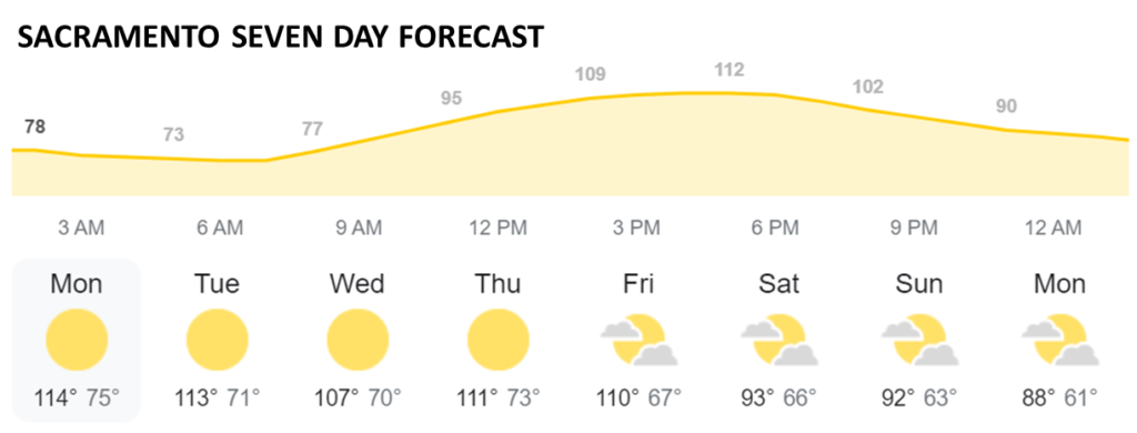
[Updates Below] According to the National Weather Service in Sacramento that region and most of California will experience, “a prolonged period of dangerously hot conditions with record and near record temperatures up to 105 to 115 degrees. Limited overnight relief, especially in the foothills… The most significant heat is forecast to occur Monday and Tuesday with excessive heat continuing through at least Thursday.”
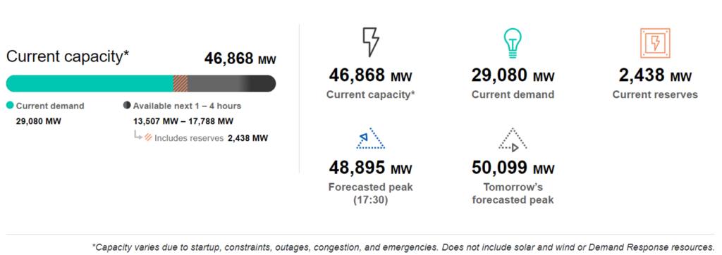
According to the California Independent System Operator (CAISO), “We are facing a load forecast of 48,817 megawatts and energy deficits between 2,000 and 4,000 megawatts for Monday, resulting in the highest likelihood of rotating outages we have seen so far this summer.”
Real time balance of supply capacity and demand can be monitored at the CAISO website. Late afternoon local time today and tomorrow are when rolling blackouts are most likely to be implemented to avoid even worse outcomes. Below is how the emerging deficit is reported early this morning by CAISO. More and more and more and more.

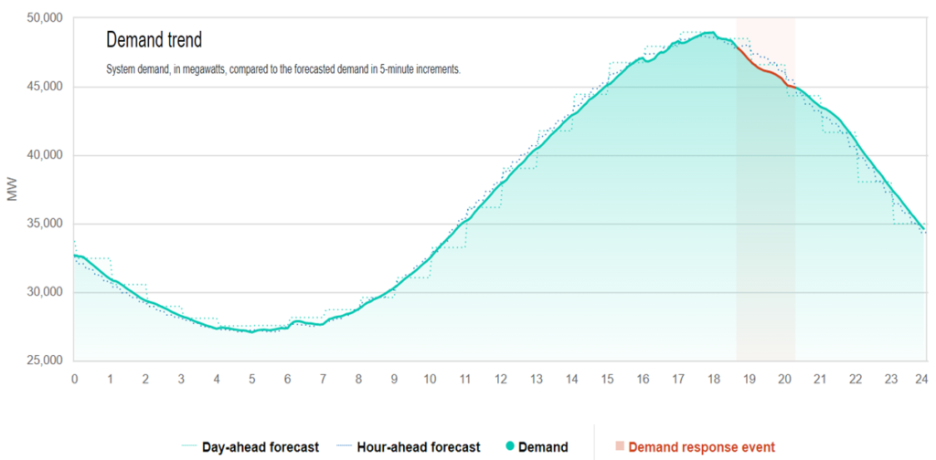
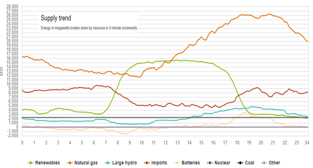
September 6 Update: As Wellington supposedly said of Waterloo, “It has been a damned nice thing — the nearest run thing you ever saw in your life.” Below are charts displaying Monday, September 5 demand and supply. Very close, but “rotating outages” were avoided for one more day. CAISO reports that demand behavior has been crucial to balancing flows. Imports (interchange) from neighboring regions were also important (please see below). For today the ISO is projecting “supply deficiencies of 400 to 3,400 MW between the hours of 5 p.m. and 9 p.m.” California time. The Sacramento Bee has a helpful overview (more).

